Using Global fishing watch's data to build a machine learning model that can identify illegal fishing and poaching activities through satellite and geo-location data.

Overview

Catching-Illegal-Fishing

Using Global fishing watch's data to build a machine learning model that can identify illegal fishing and poaching activities through satellite and geo-location data.

Global fishing watch is a partnership between Google and Oceana to map all trackable fishing activity in world, in almost real time. This is a personal project using the data provided by global fishing watch.

The data provided has vessel ids, types and coordinates of encountered vessels.

Given same vessel type and are, a fishing vessel has a different trajectory than a non fishing vessel. I used the data provided to train my model on predicting whether a vessel is fishing or not.

#Local Environment Setup Python 3.7++ Tensorflow version >1.14.0,<2.0 from (https://www.tensorflow.org/get_started/os_setup) pip install google-api-python-client pyyaml pytz newlinejson python-dateutil yattag

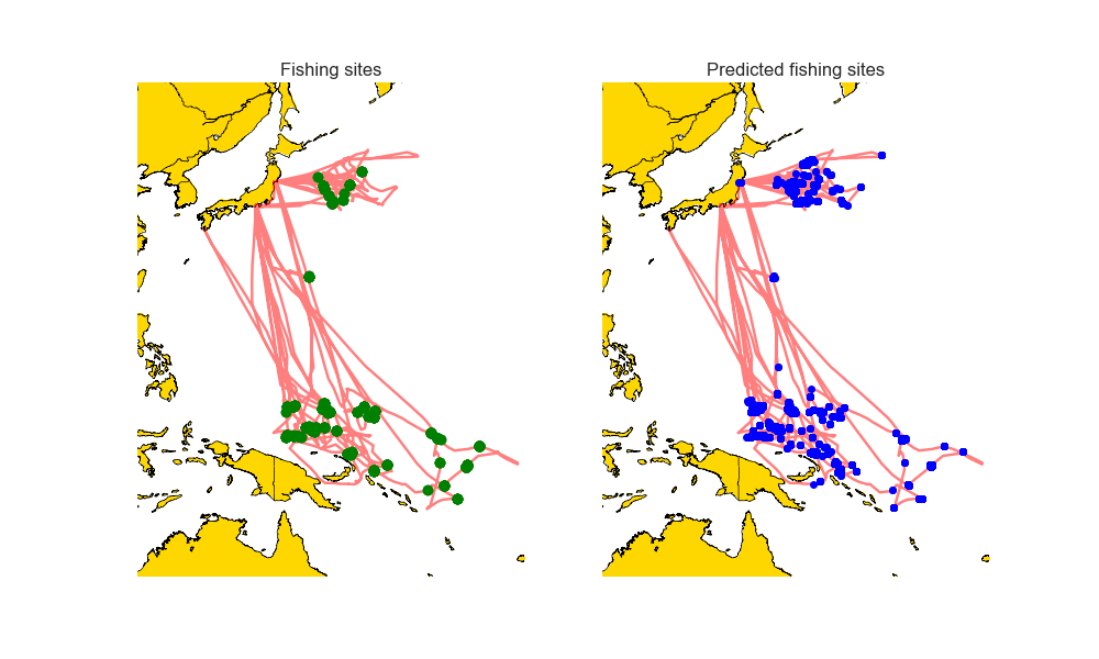
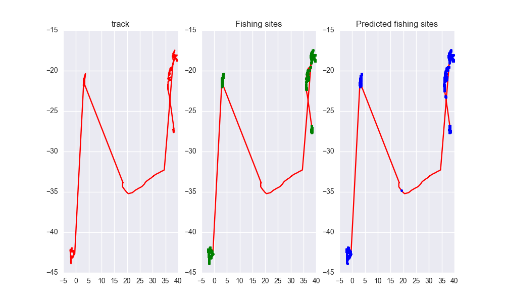
#Model Result image

image

image

image

image

image

As you can see the predicted tracks are extremely close to the real paths.
Owner
Ayush Mishra
Machine Learning enthusiast.
Ayush Mishra
Pandas Network Analysis: fast accessibility metrics and shortest paths, using contraction hierarchies :world_map:

Pandana Pandana is a Python library for network analysis that uses contraction hierarchies to calculate super-fast travel accessibility metrics and sh

Urban Data Science Toolkit 321 Jan 05, 2023
Python bindings and utilities for GeoJSON

geojson This Python library contains: Functions for encoding and decoding GeoJSON formatted data Classes for all GeoJSON Objects An implementation of

Jazzband 763 Dec 26, 2022
iNaturalist observations along hiking trails

This tool reads the route of a hike and generates a table of iNaturalist observations along the trails. It also shows the observations and the route of the hike on a map. Moreover, it saves waypoints

7 Nov 11, 2022
Starlite-tile38 - Showcase using Tile38 via pyle38 in a Starlite application

Starlite-Tile38 Showcase using Tile38 via pyle38 in a Starlite application. Repo

Ben 8 Aug 07, 2022
Cloud Optimized GeoTIFF creation and validation plugin for rasterio

rio-cogeo Cloud Optimized GeoTIFF (COG) creation and validation plugin for Rasterio. Documentation: https://cogeotiff.github.io/rio-cogeo/ Source Code

216 Dec 31, 2022
Asynchronous Client for the worlds fastest in-memory geo-database Tile38

This is an asynchonous Python client for Tile38 that allows for fast and easy interaction with the worlds fastest in-memory geodatabase Tile38.

Ben 53 Dec 29, 2022
Color correction plugin for rasterio

rio-color A rasterio plugin for applying basic color-oriented image operations to geospatial rasters. Goals No heavy dependencies: rio-color is purpos

Mapbox 111 Nov 15, 2022
iNaturalist observations along hiking trails

This tool reads the route of a hike and generates a table of iNaturalist observations along the trails. It also shows the observations and the route of the hike on a map. Moreover, it saves waypoints

7 Nov 11, 2022
Manage your XYZ Hub or HERE Data Hub spaces from Python.

XYZ Spaces for Python Manage your XYZ Hub or HERE Data Hub spaces and Interactive Map Layer from Python. FEATURED IN: Online Python Machine Learning C

HERE Technologies 30 Oct 18, 2022
geemap - A Python package for interactive mapping with Google Earth Engine, ipyleaflet, and ipywidgets.

A Python package for interactive mapping with Google Earth Engine, ipyleaflet, and folium

Qiusheng Wu 2.4k Dec 30, 2022
A Jupyter - Leaflet.js bridge

ipyleaflet A Jupyter / Leaflet bridge enabling interactive maps in the Jupyter notebook. Usage Selecting a basemap for a leaflet map: Loading a geojso

Jupyter Widgets 1.3k Dec 27, 2022
A GUI widget for Linux to show current time in different timezones.

A GUI widget to show current time in different timezones (under development). To use this widget: Run scripts/startup.py Select a country. A list of t

B.Jothin kumar 11 Nov 10, 2022
A part of HyRiver software stack for handling geospatial data manipulations

Package Description Status PyNHD Navigate and subset NHDPlus (MR and HR) using web services Py3DEP Access topographic data through National Map's 3DEP

Taher Chegini 5 Dec 14, 2022
Python interface to PROJ (cartographic projections and coordinate transformations library)

pyproj Python interface to PROJ (cartographic projections and coordinate transformations library). Documentation Stable: http://pyproj4.github.io/pypr

832 Dec 31, 2022
Django model field that can hold a geoposition, and corresponding widget

django-geoposition A model field that can hold a geoposition (latitude/longitude), and corresponding admin/form widget. Prerequisites Starting with ve

Philipp Bosch 324 Oct 17, 2022
Histogram matching plugin for rasterio

rio-hist Histogram matching plugin for rasterio. Provides a CLI and python module for adjusting colors based on histogram matching in a variety of col

Mapbox 75 Sep 23, 2022
Water Detect Algorithm

WaterDetect Synopsis WaterDetect is an end-to-end algorithm to generate open water cover mask, specially conceived for L2A Sentinel 2 imagery from MAJ

142 Dec 30, 2022
Client library for interfacing with USGS datasets

USGS API USGS is a python module for interfacing with the US Geological Survey's API. It provides submodules to interact with various endpoints, and c

Amit Kapadia 104 Dec 30, 2022
This GUI app was created to show the detailed information about the weather in any city selected by user

WeatherApp Content Brief description Tools Features Hotkeys How it works Screenshots Ways to improve the project Installation Brief description This G

TheBugYouCantFix 5 Dec 30, 2022
Advanced raster and geometry manipulations

buzzard In a nutshell, the buzzard library provides powerful abstractions to manipulate together images and geometries that come from different kind o

Earthcube Lab 30 Jun 20, 2022